In the third ten-day period of March in Ukraine different weather was observed both with negative temperatures and a sharp warming. The movement of a cold atmospheric front across the country at the beginning of the decade, along which Arctic air spread, caused the air temperature to drop to night frosts. In the last days of the ten-day period an intense increase in air temperature occurred again, which changed with another intense cooling.
The average regional ten-day air temperature in the western and north-western regions was close to normal, in the rest of the territory it was 1.5-2.5 °C higher than the norm and ranged from 2.8 °C in the west of the country to 7.2 °C in the south of the country. The minimum air temperature dropped to minus 4-10 °С, the maximum on warm days reached 17-23 °С.
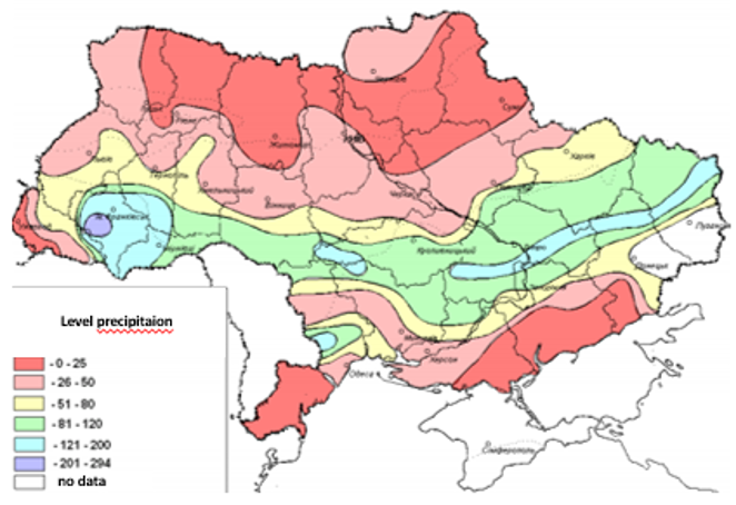
Precipitation, mostly insignificant, was noted for 1-3 days in the form of rain, during the cold snap there was snow and wet snow. In most regions, the total amount per ten days did not exceed 2-9 mm, and only in certain areas of the central and western regions it reached or slightly exceed the norm (13–27 mm).

As of March 31, the reserves of productive moisture in the tilth-top soil under winter crops in most areas were still sufficient – from 21 to 35 mm.
Most winter crops were in the tillering phase, and in places in the central regions 3rd leaf sprouted. In winter rape in most areas the formation of a leaf rosette and stem growth continued, in the central and southern regions the formation of inflorescences was noted. The condition of the crops is mostly satisfactory, however, in many areas, damage to the leaf surface of crops by night frosts was recorded. During the ten-day period sowing of spring barley and oats continued. Grain germination was observed on previously sown areas seedlings were formed in the southern regions, and the third leaf was observed in places on very early crops.